



Buca 3 derece oldu sıcaklık düşüşü beklenenin üstünde mi ?
mgmye göre 7 derece olması gerekiyor 
Buca 3 derece oldu sıcaklık düşüşü beklenenin üstünde mi ?
mgmye göre 7 derece olması gerekiyor

yarın çatalkaya ya çıksam kar durumu nedir yağış var mı ?
Yağış olmasa bile örtü vardır
07 Şubat - 20.05
Açık
Bergama kozak yolu saat önce
ceb07cf30f9660a665f6c5b8d.jpg
75a50902dbab49250.jpg
i

Ustalar bizim yaylada yıldızlar görünüyor yağış konusunda bilgi verebilecek olan var mi
ilerleyen saatlerde gelmesi gerekiyor yağış
Onur35 usta son otobüs değil mi o nasıl döneceksin
Narlıdere anlık 4.9
Bergama 3.8 oldu
İzmir'in merkez ilçeri Narlıdere ve Gaziemir 5 dereceye geriledi neredeyse(kütlenin etkisi var tabi)
b174d5c218617070c3.png
A level 1 was issued across the east Mediterranean mainly due to severe wind gusts, tornadoes, and excessive precipitation. Additionally, waterspouts are expected.
SYNOPSIS
Deeply amplified intense mid-level trough progresses eastward and crosses the east Mediterranean. Ahead of its well-developed frontal zone, a warm southerly flow advects moist air from the Mediterranean towards Turkey and farther into the east Black Sea region and southern Russia. Thunderstorms are expected in the east Mediterranean region, although lapse rates are quite marginal. West of the advancing cold front, polar air masses spread into the Mediterranean. Western Europe is affected by a well-developed ridge.
DISCUSSION
A cold front moves east across the east Mediterranean. Prefrontal warm air mass is relatively moist, with a mixed-layer low-level mixing ratio around 9 g/kg, but lapse rates will be not too steep. Weak CAPE is expected to develop that will slightly improve close to the cold front, supported by frontal lift and low-level stretching. Latest models indicate some 10s J/kg MLCAPE. Equilibrium level temperature around -10°C will be quite high, and thunder is in particular forecast along the shores, where upslope flow adds to the local lift. Along the cold front, linearly organized convection is forecast, favoured by long, straight-line hodographs and front-parallel storm motion vectors. Severe wind gusts are forecast, especially when bowing segments manage to form. Additionally, tornadoes are not excluded, as the low-level flow is modified by the topography, allowing for higher SRH values, e.g. in the wake of Cyprus. Finally, heavy rain is forecast in the upslope flow regime across southern Turkey.
In the wake of the cold front, lapse rates increase towards the base of the mid-level trough. A well-developed mid-level front will be associated with further low-level stretching. Although low-level moisture will also decrease with the advection of polar air masses and increasing vertical mixing, showers and thunderstorms are forecast over the rather warm sea surface. Vertical wind shear will be significantly weaker compared to the frontal zone, and storms will become less organized. Main threat will be local severe wind gusts with stronger storms.
Close to the base of the mid-level trough, waterspouts are forecast close to the shores, initially over the southern Aegean Sea, later on also along the shores of south-western Turkey.
Storm Chaser hocam deniz üzerindeki kütlenin maşallahı var deli gibi oraj yapıyor
Sizce erimeden karaya ulaşabilirmi
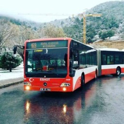
Gökgürültülü çok kuvvetli graupel yapar merkeze de fena dolu bırakır
.
swisste bu şekilde gelmiş
85c90ad70c7a0.png
Ege'den acayip bir şey geliyor arkadaşlar
24ece34259d389c3ca301.jpg
Radarı vurursa fena olur hava-kars323
Karabağlar radar 1.5 dereceye kadar geriledi
Sence yarın akşama doğru ege denizi modellerin gösterdiği gibi temiz olur mu yoksa bir kaç kütle oluşabilir mi ? 700,500 rüzgar yönleri karayel ve günbatısı arasında çünkü PergamoN
Çatalkaya radar daha soğuk girmeden güzel düştü gece kar seviyelerine düşebilir.
05 Şubat - 18.06
Yağışlı

Yağmur yere paralel yağıyor,fırtına kopuyor, şimşek gök gürültüsü , film platosunda gibiyim sanki..Allah afetinden korusun,bir kaç saat dışarıya çıkmayı önermiyorum..
aynen tipi gibi yağmur yağıyor aksiyon bol

Kuvvetli bir fırtına hattı yaklaşıyor.
Deniz üzerinde oraj var hocam hava-simsek3232hava-simsek3232
ac0272d17bab954e14a5.png
fdc6dbbf907a0ff5018a2fd0.png
A level 2 was issued across Turkey mainly for tornadoes, severe wind gusts and to the lesser degree for excessive rainfall.
A level 1 was issued for northeastern Greece, western and southern Turkey mainly for tornadoes, severe wind gusts and to the lesser degree for excessive rainfall.
DISCUSSION
... Aegean Sea, northwestern Greece, western and southern Turkey...
Ahead of the advancing cold front, NWP simulates a plume of modest moisture being advected from southwest and progressing well inland of Turkey and towards the Black Sea. Combined with 6.5 - 7 K/km lapse rates the moisture should suffice for marginal CAPE values. Storms will form along and ahead of the cold front in the environment of very strong vertical wind shear, both in lower and mid troposphere. In the bottom 1 km, models simulate bulk shear over 20 m/s over western Turkey. Furthermore, curved hodographs will allow for locally 200 - 400 m2/s2 of SRH in the 0-1 km layer. Such conditions, in conjunction with low cloud bases, point to threat of tornadoes, including strong ones. Besides tornadoes, severe wind gusts are likely as well along the convective line that will form along the front.
Ultimately, the severe threat will depend on CAPE, which will be marginal at best, and whether it is surface based as the storms progress from the coast inland. Nevertheless, threat seems high enough to warrant a Level 2 for part of the discussed area.
İzmir merkez uçuyor
